The (digital) RSRG tools that rail infrastructure companies can rely on for their tunnel projects:
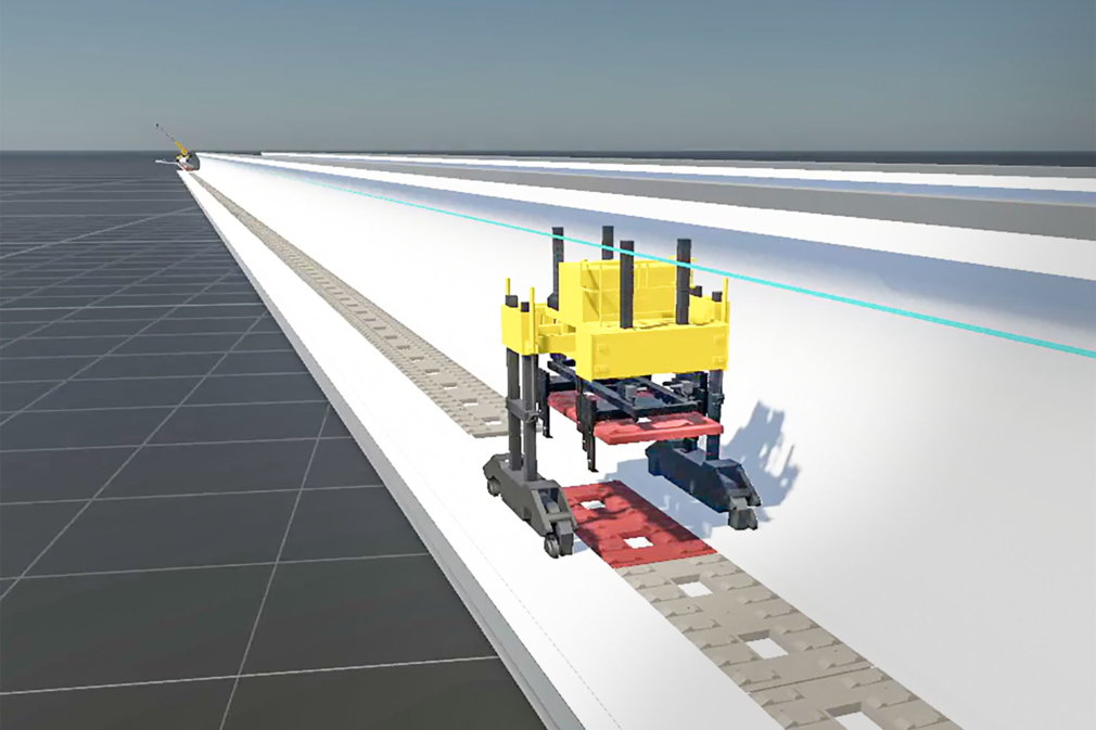
dProB: more than just a logistics simulation
This tool enables detailed planning of tunnel construction sites, taking into account both construction phases and ongoing rail operations. With realtime visualisation, users can simulate workflows and logistics in a digital environment. The software integrates timetables, actual train movements, and the modelling of resources and personnel, creating a realistic overall picture of the construction project.
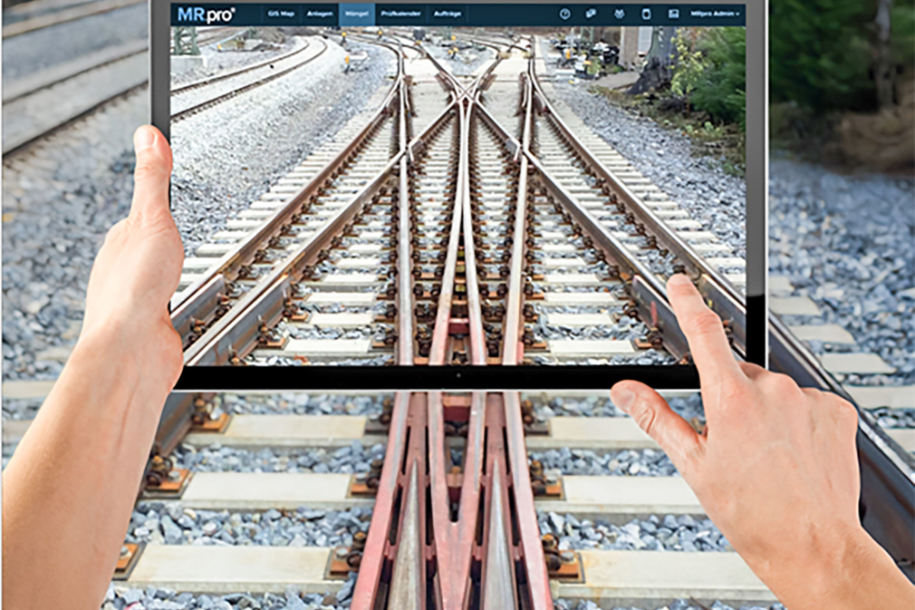
Track and turnout maintenance: efficient life cycle extension
Intelligent RSRG tools like MR.pro®, field-tested for over 30 years, actively support rail infrastructure companies in managing their track networks. For example, the inventory data of a turnout installed as part of a BIM process is evaluated and seamlessly linked with inspection data recorded during the construction phase. The collected inspection and maintenance data create a complete history, enabling accurate forecasting of the turnout’s future performance and service life.
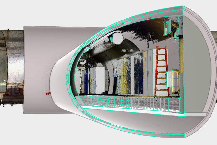
BIM: better communication and faster construction processes
In tunnel renewals, especially when upgrading tunnel radio and mobile communication systems, Building Information Modelling (BIM) plays a key role. BIM enables precise planning, coordination and documentation of all measures. By digitally modelling the tunnel, cable routes, antenna locations and maintenance access points, all elements of the project can be efficiently coordinated. This shortens construction time, reduces risks, and delivers infrastructure which is future-proofed.
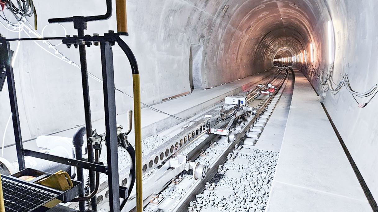
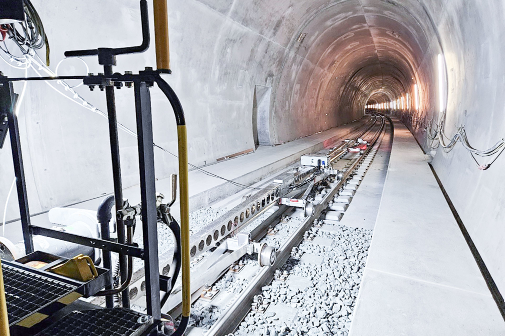
FahrwegDiagnose: holistic data competence
RSRG operates a dedicated measuring vehicle for metre-gauge railways, already in regular use with over 15 Swiss and two French railway operators. In addition to recording track and overhead line geometry, measurements are often supplemented by deflection analyses. In tunnels with slab track, the data provides valuable insight into the transition zones to ballasted track. The specialist platform IRISSYS© is used for time-series analysis of linear data. It not only contains measurement results but also infrastructure information and records of completed and planned maintenance activities. Interfaces to GIS or asset management systems are essential – and corresponding functionalities are available.
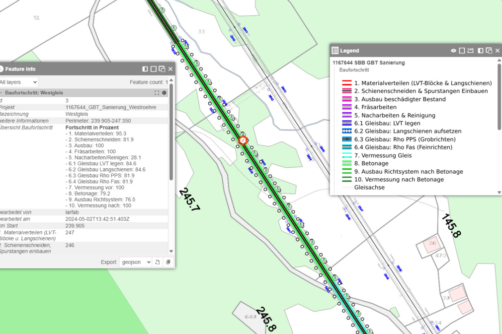
Maps of RSRG: the construction site at a glance
The RSRG WebGIS visualises a wide variety of data types and information in spatial relation to the construction site, available in real time on an online platform. In the construction progress module, data can be managed within individually defined process segments. This makes the project status visible to all stakeholders, helps identify critical phases more easily, and enables targeted action.