Revolutionising site documentation.
New technologies such as 360° cameras, drones and GNSS survey stations are optimising documentation and simplifying billing – another major step towards the digital construction site.
In today’s construction industry, precise and efficient documentation is essential to meet growing demands for transparency and traceability. The introduction of GNSS survey stations (commonly referred to as “site poles”) has set a new standard that is transforming construction site documentation.
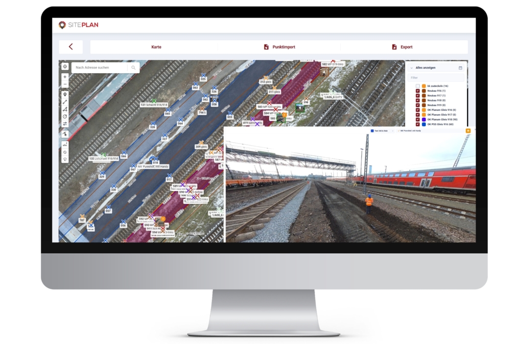
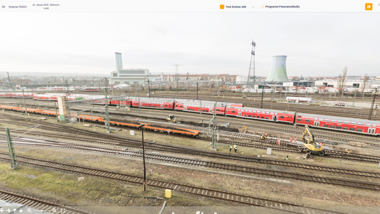
The Dresden-Altstadt project clearly illustrates how the recording, documentation and measurement of various activities can be significantly simplified and optimised. A key element of this innovation is the integration of new 360° cameras. These can be used independently or in combination with the GNSS survey station. The resulting 360° images offer a complete visualisation of the entire construction site and its subcomponents. By uploading the images to the SitePlan software platform, documentation is not only improved but communication between project stakeholders is also enhanced. Thanks to this visual clarity, progress and challenges are visible at a glance, enabling better-informed decisions.
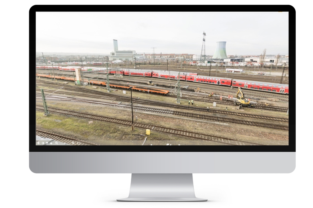
Regular drone flights further contribute to measurement accuracy and traceability. These aerial overviews provide clear and tangible visualisations of construction progress. The combination of 360° cameras, drone technology and centimetre-level point capture via GNSS stations creates a robust data foundation – one that streamlines billing while also strengthening on-site quality assurance.
The construction industry is entering a new era, in which digital solutions are paving the way for a future-proofed and sustainable way of building.